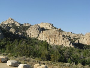
I got up on Tuesday morning, and left Camping World to head towards Bruneau Dunes State Park in Mountain Home, ID which is between Boise and Twin Falls. I posted photos on the photo gallery page of all the parks and traveling the backroads that I have done for the past 2 days. It’s been quite an adventure!!!
Photos of Back Roads and Idaho towns
I drove the interstate from Boise to Mountain Home since it was the most direct route. It was flat prairie for the most part and the road was under construction so it was 1 lane of traffic each way. I saw lots of burnt prairie and could smell smoke very strong and see smoke and haze all around including in the distance. I found out later on that it turns out that there was a lighting strike a few days before that set off 7 fires in various areas and several were still burning. In fact, a few times I saw a couple of helicoptors with buckets hanging that probably were to put out fires.
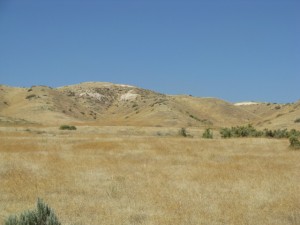
Bruneau Dunes was pretty interesting, the drive there was really another confirmation of how quickly the scenery and landscape changes. Everything is so dry here, the prairies are all dead grass and dirt, except for the sagebrush or occasional trees. I was driving through flat prairie and then went down a hill or the mountain, then around a curve and a wide vista opened up with the Snake River, canyons, hills, green grass, farmland, etc. I wished I had my camera handy for the photo. It was such a sharp contrast from what I had been driving through. Maybe you can tell from some of the pictures. Also, sometimes driving on the roads I see one side of the road dry and flat, the other mountains or farmland.
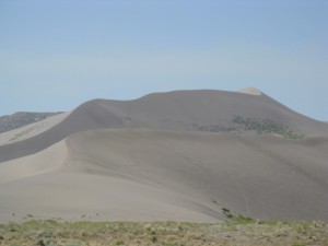
Anyway, I arrived at the dunes state park and drove the 3 miles to the dunes which were at the end of the road. I saw lots of footprints going up the dunes, but decided that I didn’t want to walk up them, especially in the heat. So I settled for taking pictures, and having lunch looking at the dunes. There are 2 campgrounds in the park, and there were only a couple of campers, I didn’t want to just camp at a site under the hot sun, and it was about noon, so I continued on my journey to Three Island Crossing a little further east where pioneers continued on the Oregon Trail. There are still ruts visible on the mountainside, I took some pictures, more of which you can see on the photo gallery page.
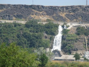
Continuing on east, I stayed on backroads taking the scenic byway which included parts of the Oregon Trail and followed parts of Snake River. I passed what is called Thousand Springs, which are many waterfalls springing from a wall at Snake Creek Canyon. It was a pretty drive. One of the waterfalls is an optical illusion, it looks like it is flowing onto a building in the front of it. I thought that was pretty interesting.
Because it was about 3 p.m. I thought I would continue on to City of Rocks National Reserve which was a couple of hours away. That’s where my trip got more interesting for several reasons. Some good, some funny (sort of), and also one that was not as fun but it worked out okay.
Since I was on the west side of City of Rocks, looking at the map it seemed to be a shorter route to continue on a scenic byway and then go down some secondary roads through small towns instead of taking Interstate 84 and coming down from the north and east side of the park…. looking back, not sure it was the best driving decision I have made, but it made the trip more interesting and very dusty and bumpy!!!
Here’s where it starts to get interesting… depending on your view of the situation. It’s better looking back at it, but in all honesty, since I knew that God is in charge and things were okay, it didn’t rattle me much, except for driving for 16 miles or so when I got to the bumpy, dusty, washboard gravel roads in the mountains.
Anyway, since I had a little more than half tank of gas, and I knew I would be heading into backcountry away from any towns, when I passed through Buhl, just west of Twin Falls, I stopped for gas. It was a little more expensive than other towns, so I put $50 worth of gas in the camper which almost filled the tank. Whenever I get gas, I put the credit card in my pocket, pump gas, then I get in the van and put my credit card in my wallet, record my mileage, then continue on. However, for some reason, this time, besides wearing my jeans with shallow pockets, I went inside and asked for directions on taking a road connecting Buhl with Oakley which is just north of the road I wanted to take to City of the Rocks. I wasn’t sure that Hwy. 30 would go all the way through, the GPS wanted to route me back to the Interstate and the map looked like the highway would continue on.
Well, I went inside and there was an elderly gentleman inside, he got out a map and we looked at the route, he said he agreed that it looked like Hwy. 30 continued on and that I could go the way I planned. We also saw on the map that there was a gravel road to City of the Rocks, once I got past Oakley. I thanked him and continued on my way. I got in the van and thought I put my credit card in my wallet… that’s how good my memory is. I’m guessing that not sleeping hardly at all during the night didn’t help my memory. When I was at Camping World in their parking lot, between the highway noise, and my body, I hardly got any sleep. Back to the story. I headed out again and about half hour or an hour later, I saw the Interstate, but tryed to stay on the backroad and after driving several miles, I decided to turn around and go back to a service station I saw to ask directions since it didn’t look like Hwy. 50 I was on was going to the right place. Somehow Hwy. 30 stopped I guess when it passed the Interstate.
I found out that I needed to get on the Interstate at the intersection where the gas station was. I thanked the attendant and continued on until I got to Burley then heading south to Oakley and City of Rocks. When I got to Burley, I saw a reasonably priced gas station and decided to fill the gas tank. I reached into my wallet for the Chase credit card I use for gas, and it wasn’t there!!! I could have sworn I had put it in my wallet at Buhl. I looked all through the camper and my maps, etc. and I found the receipt from the gas in Buhl, but no credit card. It was about an hour and half since I had used it. I didn’t even have the phone number to Chase to call them, so I called a different credit card company to get a phone number for Chase and finally got in touch with the lost card department. I explained my situation and told them when I camped for the night, I would look more carefully to see if I could find the card, maybe I put it somewhere different for some reason. They said that since I contacted them I would not be responsible for any charges. The credit card company found the phone number for the gas station in Buhl and called them, they did not see my card anywhere on their premises. The only other place I could have lost it was at the service station near the Interstate, and I doubt I could have found it again. I don’t know what exit it was heading west.
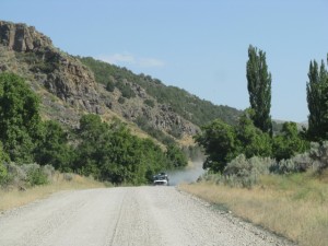
Anyway, I continued on to City of the Rocks. I drove through Burley, and Oakley. Oakley was a really small town with houses, and only a few businesses. The paved road ended when the road curved with the sign for City of Rocks. I think it said something like 16 miles. I thought another gravel road!!! So much for my clean camper which I washed the day before at my campsite in Hells Canyon. Well, this was not only a gravel road, but a unsmooth bumpy road, most of it felt like I was driving on a washboard with grooves. This seems to be the case on most of the gravel roads I have driven on in various states. I don’t know how, but the dust even comes into the camper with the window closed. If I ever buy another vehicle, it needs to be a 4 wheel drive, diesel, off road one since it seems I travel that way pretty often.
I drove about 10 miles per hour on this really bad gravel road which winded up and down the mountain. Occasionally a pickup truck would be coming from the other direction, traveling fast and covering me in a cloud of dust!!!
It was not fun, besides concentrating on driving this road and not knowing how much longer I had to do it. Finally, about an hour later, I saw the entrance sign to City of Rocks… another steep bad gravel road. It was also open range and I saw some cattle, including a few along the side of the road, we just looked at each other and kept on doing what we were doing, they ate grass and I drove on. 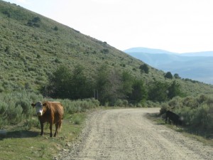
I finally came to a fork in the road, one sign said US Forest Service Campground, so I took that road… another STEEP bumpy road, however, when I got to the top of the mountain, the view was spectacular looking down at the rocks. 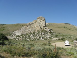
I decided since no one was camped up there that I didn’t want to be on the top of the mountain by myself and there were no hookups either. So I continued back down looking at rock formations that were magnificent.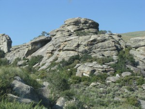
I saw another road, but didn’t know where it went, I saw it going up into the mountain. I decided instead of taking that road, I would go back down the mountain the way I came and take a road I thought went towards a small town where I might be able to camp. Well, when I went down and took the left, the sign said the name of a small town, then it said UT. I didn’t want to go to Utah yet, and I looked at the map again and tried to find the road I wanted. It turns out that I had to go back into the park and take that steep road up the mountain that I saw before.
I turned around very carefully on the road since there was no where to turn, thankfully only very few vehicles are on these back roads. I went back up the bumpy gravel road. As I went up the mountain, there were more cattle, and some where in the road. In fact, in one spot there were about 6-7 cows and I wondered if I could get past them. It seemed they were on both sides of the road. I went slow and when I got close to the herd, they walked across the road, looked at me, and then cleared the road so I could pass, thankfully. I had a vision of me there until they decided to move. 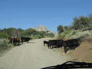
When I came to the fork in the road, instead of taking the National Forestry Service road, I went the other way, which took me up more bumpy gravel roads that were pretty steep and finally, as I came around a curve, the landscape changed to this majestic, magnificent, display of rocks scattered around the mountain. I’m guessing that was the beginning of City of the Rocks from the western side. After a few miles, I started to see some cars and people and the road became a fairly packed down dirt road, rather than the gravel. It was still steep and windy and went through the mountains.
I saw several campground areas and drove through a couple of them. They were fairly level, some larger spots than others, still dusty and there were no hookups for electric or water which is okay. I continued down the mountain to see where there might be a fee station or visitor center. It was about 7 p.m. so the visitor station was closed.
I talked with someone at a small restaurant at the base of the mountain in Almo and it turns out her husband is a ranger so she called him. This park is a combination, National Forest Service, National Park Service (operated by the State of Idaho, and an Idaho State Park. The Idaho Park service has a campground there that is on paved roads with electric and water connections, so that is where I decided to camp. By then it was 7:30 p.m. and I was ready to eat something for dinner. I found a campsite on the top of the mountain looking into the valley, it was really nice. After dinner, I got out my hose and rinsed the dirt off the camper, it was really bad from the gravel roads.
I was surprised to find that I had cell phone coverage so I made a few phone calls, I am now only 2 hours earlier than EST. I went into the camper and looked through everything and no credit card surfaced. I got out my campground book to see what is nearby, I joined Passport America before my trip and have not used them yet, so I looked in the book and found a campground that was about an hour or so from City of Rocks, I called and they had spaces available, they also have showers, laundry, a pool, etc. and are near the Interstate. I asked if I could have something sent to me and get it on Thursday and they said yes. So, I called Chase and they are going to send me a new credit card on Wednesday overnight, so I will have it on Thursday, then I will continue east to American Falls and Massacre Rock State Park. How blessed am I? Very much so!!! I wasn’t too upset about losing the card, I only have a few auto pays that get charged to it, and two of the ones I thought I did, when I called the businesses to change the number, it turns out my monthly bill was not charged to that card anyway. Everything works out the way it’s supposed to when I have faith and I take the action I can, and I leave the results to God!!!
For the first time in a while, once I got to sleep which was about 10:30 p.m. I slept through the night until about 6 a.m. It might have something to do with not sleeping the night before, or it could be how still and quiet it was at night. There was no sound in the campground, there were only a few campers and none close to me. I heard the bugs chirping, and a little wind blowing. Other than a bright moon which looked like a flood light, there was no other light. I was able to see the entire sky and all the stars. I saw the Big Dipper and North Star and they were higher in the sky, it was probably that the mountain wasn’t as high as the one in Hells Canyon. As I left the park, I stopped at the Visitor Station and got info on City of the Rocks, Castle Rocks, and the California Trail, which is similar to the Oregon Trail but it was a slightly different route. It will give me something to read later on. If you want to know more about City of Rocks, I’m sure you can find it on the Internet and the National Park website.
I got up this morning and cooked myself an omelet with cheese, spinach, and sausage and some home fried potatoes and sat at the picnic table looking at the scenery. I also am thankful I bought a 25′ extension cord which allowed me to cook breakfast at the picnic table, and now is allowing me to type this long story outside at a picnic table under a tree at my campsite. I can hear some traffic from the highway, but it’s not bad. I also can see the Snake River along the highway, and there is a pasture with the horses and colts, 4 of each. 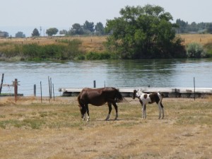
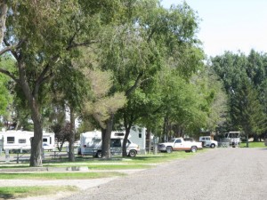 When I arrived at the campground, I was given a great site under a tree and next to a building with a shower. I ate lunch, took a shower and washed my hair, and then did my laundry including the rugs in the camper that thankfully get most of the dirt I track in, or that blows in. I bought woven rag rugs that I have lining the entire center isle in the camper and they can be washed easily. I’m surprised how much dirt gets into my cabinets, since the doors to them are closed. I have to wash my dishes, and dust my cans and plastic bottles before I open them.
One of the owners of the Village of Trees campground who is named Brad drives around in a golf cart frequently doing odds and ends like moving the hoses that water the grass, etc. I have a latch that broke on two of my cabinets, and I bought a new one for the lower cabinet door, however the cabinet over the table that opens up has a screw that came out and I couldn’t find a replacement hinge, and didn’t know how to fix the one that is there. I asked Brad and he fixed both of the latches for me, and he wouldn’t let me pay him. It only took a couple of minutes and now I have cabinet doors that won’t fly open, especially on the bumpy roads.
Well, it’s 5:30 p.m. and I am getting hungry. I started a fire in my little grill and I’m cooking 4 hamburgers. I will eat one tonight, then have leftovers for another day. That’s about if for this day’s writing. I know it was probably one of my longest. I wasn’t sure whether to tell you about the credit card incident, but it is part of my story and it worked out perfectly.
Tomorrow, after my new credit card arrives, I will go east to American Falls and Massacre Rock, not sure when I will be able to update my page again, but I will when I can. I’m very grateful and blessed today that for the first time in about 10 days I don’t hurt much and I feel a little better with a bit more energy. Thanks for your prayers.

