Oregon Trail Interpretive Center
August 11, 2011
I left Baker City this morning and went to the Oregon Trail Interpretive Center about 15 minutes east of Baker City. It was an amazing experience to put myself in the adventure the pioneers, explorers, miners, Native Americans, and mountain men took in the 1800s coming from the midwest to Oregon. As I have been driving through Oregon, at many places along the roadside there were historical signs and markers identifying the Oregon Trail. I even passed a sign that said 49th Parallel – Halfway between the Equator and the North Pole, that was pretty cool too. I also passed Emigrant State Park that was a stopping point along the old Oregon Trail.
Photos of Oregon Trail Interpretive Center
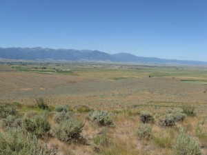
The Interpretive Center is constructed on the top of a mountain or hill, and it has an amazing view. Off in the distance is part of the Oregon Trail with ruts showing in the dirt road. I didn’t walk down to it. The ranger said it is about a 45 minute walk down, and a little over an hour back. It was all UPHILL coming back and seeing that it was hot and dry, I didn’t want to take the walk.
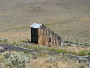
I did however, walk a short path to see an old gold mine. I didn’t walk down to the building, but I did get a photo from the sidewalk on the hill. I took lots of photos inside the center and also of the landscape outside of it, they are in my photo gallery.
Upon arriving at the center, there was a live history one woman show of man looking for a wife and that he would provide transportation to Oregon for her. She described the difficult conditions that they encountered on their travels. She was an intern there, and a great actress.
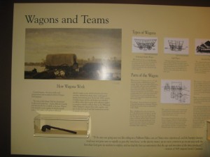
The exhibits not only showed the various types of covered wagons, oxen, mules, horses, etc. that the pioneers used to travel in, they also described the journey, trading posts, the mortality rate of how few completed the journey and that there were grave sites all along the 2000 mile trail. The wagons were not very large in comparison to the Conastoga wagons. The settlers had to bring all their supplies, food, clothes, etc. that they would need for the trip. They didn’t know if there would be anywhere along the way to buy supplies, food, etc. Also, water was very precious. Frequently, they would find a water source such as a river or lake and there would be cattle in it, thus spoiling the water for human consumption. 
The cost for the trip was expensive, from $500-$1500 on the average, and that was in the mid 1800s. . The cost of a good mule was $100 and if it was an experienced and trained mule it was more, and the possibility of theft of the animal was greater than an untrained mule.
There were periods of time along the route, especially when the terrain was difficult, that the pioneers had to walk besides the wagon for sometimes hundreds of miles. They did enjoy some of the walk because they got to talk with the other travelers. The wheels of the wagons had to frequently be greased so they would not overheat. If the wagons broke down or broke or lost a wheel on the trip, often they had to abandon their wagon. Dishes were often packed in wood barrels in with the flour, wheat, and other food supplies. They had to carefully decide what to take with them, due to the weight and limited space. I really understand that, I had to do the same thing for my extended trip.
Driving through Oregon and the surrounding countryside, not only here but in other states I passed through, I know my driving on paved or gravel roads has sometimes been challenging because of rough roads, steep mountains, very curving roads, rain, etc. I can’t even imagine being in a covered wagon, or on horseback on the trails, which were not always cleared, and definitely not paved. There were a few men during a few year span who mapped out the Oregon Trail that most settlers followed, however, it was still over steep mountains, rocks, etc. It was a very interesting and educational experience and I’m glad I stopped to explore it. This is a U.S. Department of the Interior, Bureau of Land Management, National Historic Interpretive Center, if you want more information on this you can go to www.oregontrail.blm.gov. Next stop, Oxbow Canyon, Hells Canyon recreational areas where I hope to get a campsite for a few days.
More pictures in the photo gallery.


